


Project name: Immigration Island
Building type: Immigration Museum + Monument
Location: Galveston, Texas
Programs used: ArchiCAD, Illustrator, Photoshop, Artlantis, Rhino, Grasshopper
Galveston was considered the “Texas Ellis Island” due to the many immigrants that came through the Gulf Coast. Its early period as a port of entry for Texas pioneers and the large volume of immigrants processed into the united states is a clear testimony to Galveston’s significance as an immigration port. Over 700,000 immigrants came through the port of Galveston between 1946-1948. But sadly there is almost nothing left of Galveston’s important role as a port of entry. Therefore many people don’t know about the role in which Galveston played. The only evidence are two small historical markers in separate locations. It is imperative that we remember Galveston’s role as a port of entry and recognize the many people that came to Texas so long ago and its contribution to diversity and culture. I propose to design an interactive monument and museum at one of the original sites of immigration known as Seawolf Park. By creating a place that people can interact and learn about Galveston’s forgotten port of entry, it will recognize the important role Seawolf Park played in the lives of thousand of families.
Seawolf Park, Galveston Texas
The federal station located on Seawolf Park opened in 1913 at a cost of 2 million dollars. The station was said to be second only to Ellis Island in its size and features. The station could process up to 2,500 people and could sleep 500. The 1915 storm caused substantial damage to the station and was closed in 1916.
Due to the large number of immigrants that came to Galveston Harbor, the city grew at a very rapid rate to the limits that Galveston could sustain. Introducing many different cultures and virtues.
from each side of the island. This is an important relationship because it gives visitors a view into the ship traffic that may have occured during Galvestons port of entry period. The refineries and port makes an interesting background to the serene site.
Southwest of the site it the ferry station. The ferry is constantly running past the site. Aboard the ferry it is nearly impossible not to see Seawolf park while riding accross. This has the potential to promote the new development and create a physical connection to the ferry route.
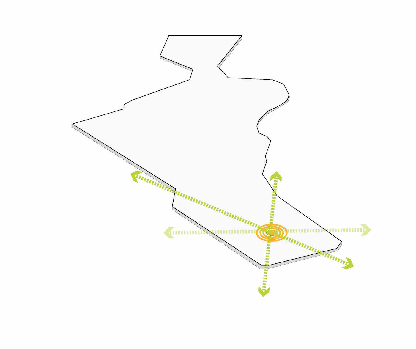
Starting in the original site of the historic lighthouse and extending out to the 360 view of the Galveston harbor.
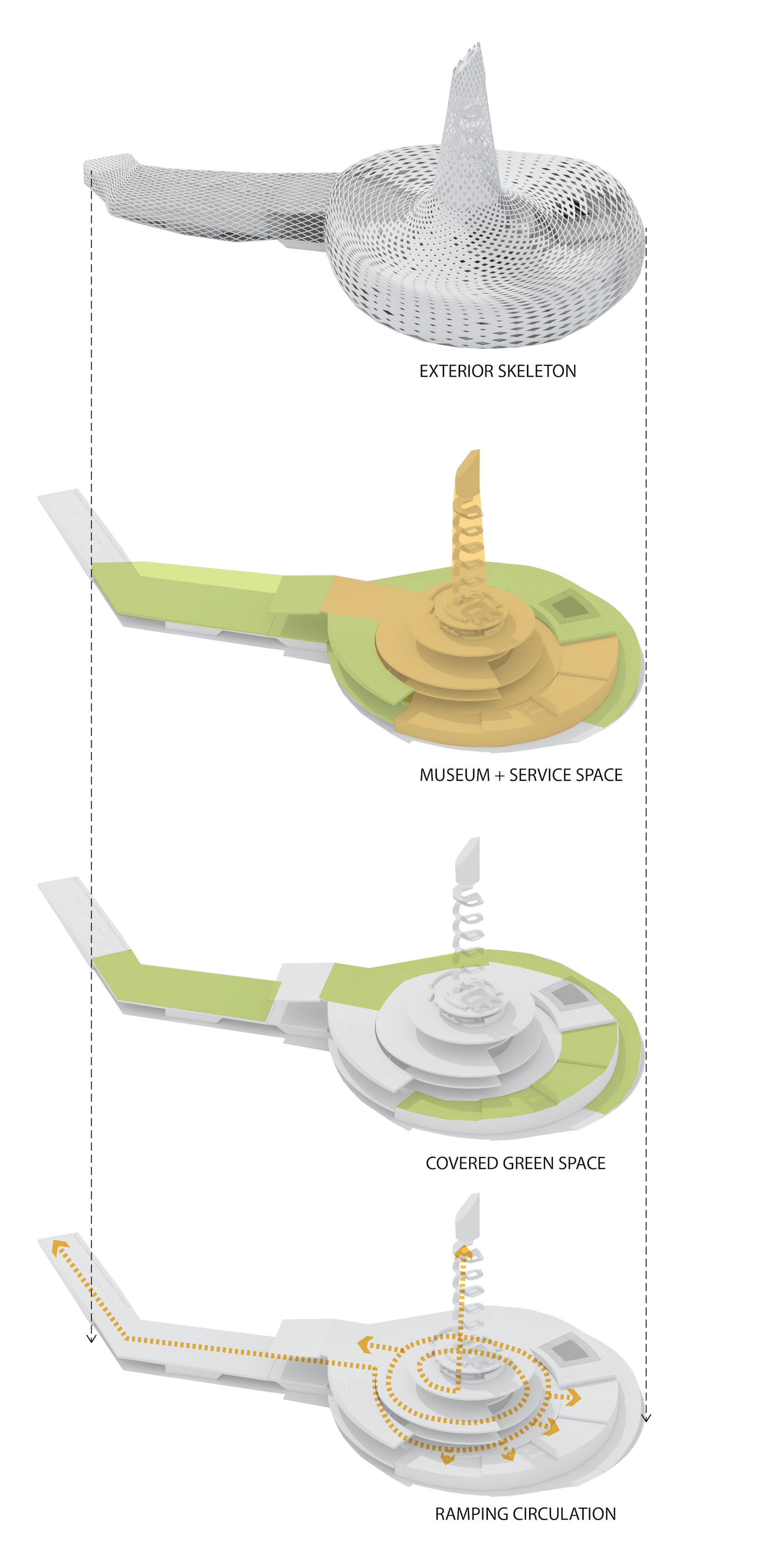
Extrude central core of building with a ramping geometry.
Surround with protective skeleton that protects the museum from extreme weather.
Lift the edges of the skeleton to open up the views and allow for water flow in extreme flooding and weather.
View decks extruded from the building, in connection with the shipping channel.
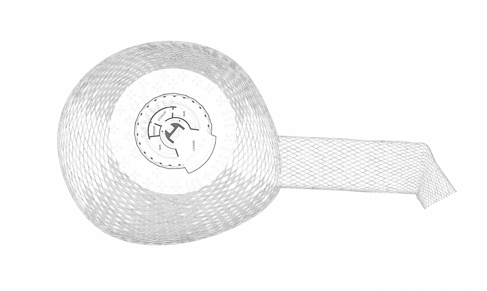
Entrance, Museum, Auditorium, Office Space
Ramping Museum
Ramping Musuem
Restuarant
Sky Bar
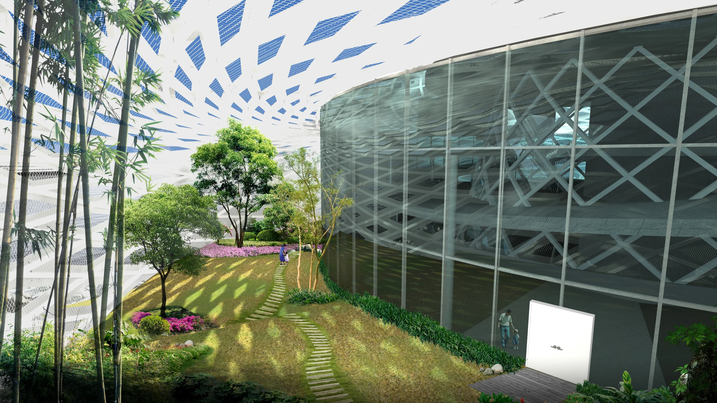
Section through outdoor museum where people can view cultural landscaping and plant types. These plants are protected, watered, and provided sun throught the buildings protective skeleton.
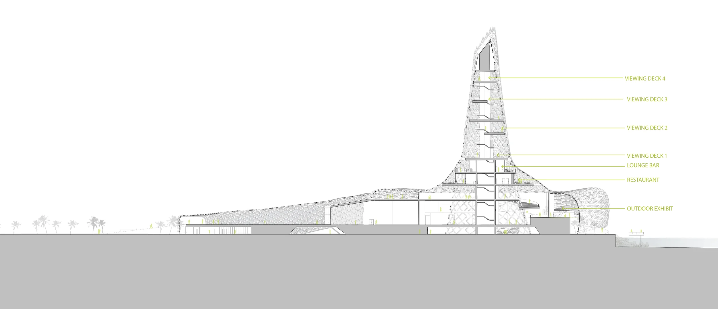
Section through the viewing deck and museum
The buildings exoskeleton lifts up at specific points on the buildings base to allow for water flow when the site floods. In order to prevent damage to the building and structure.
The panels in the exoskeleton change size according to the direction in which the panel is facing. The North and South panels and more open then the East and west.
The Tall lighthouse structure works as both stack ventilation and uses a wind turbine at the top of the tower to collect wind enrergy. Being on the Gulf wind energy is a valuable source of energy.